NavigationPLANNER is the only PC Program specifically designed for marine planning with Navionics charts.
NOW fully integrated with Theyr weather and ocean forecast services.
Plan with your PC at home, on board or in the office, transfer routes and waypoints to your chartplotter. Install on two machines.
NavigationPlanner allows you to back up all your waypoints and routes on your PC, import data from other sources and transfer them to your plotter.
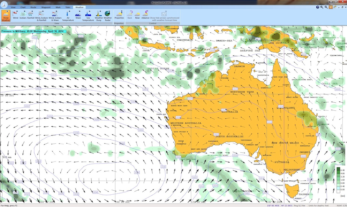
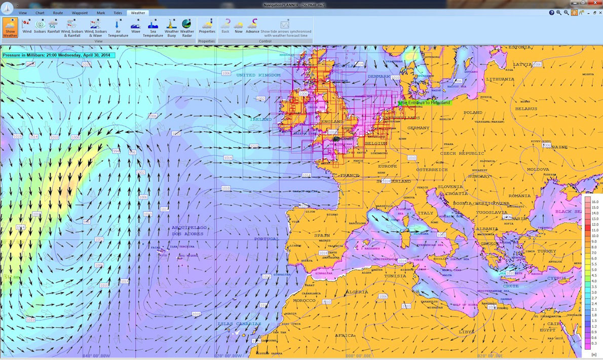
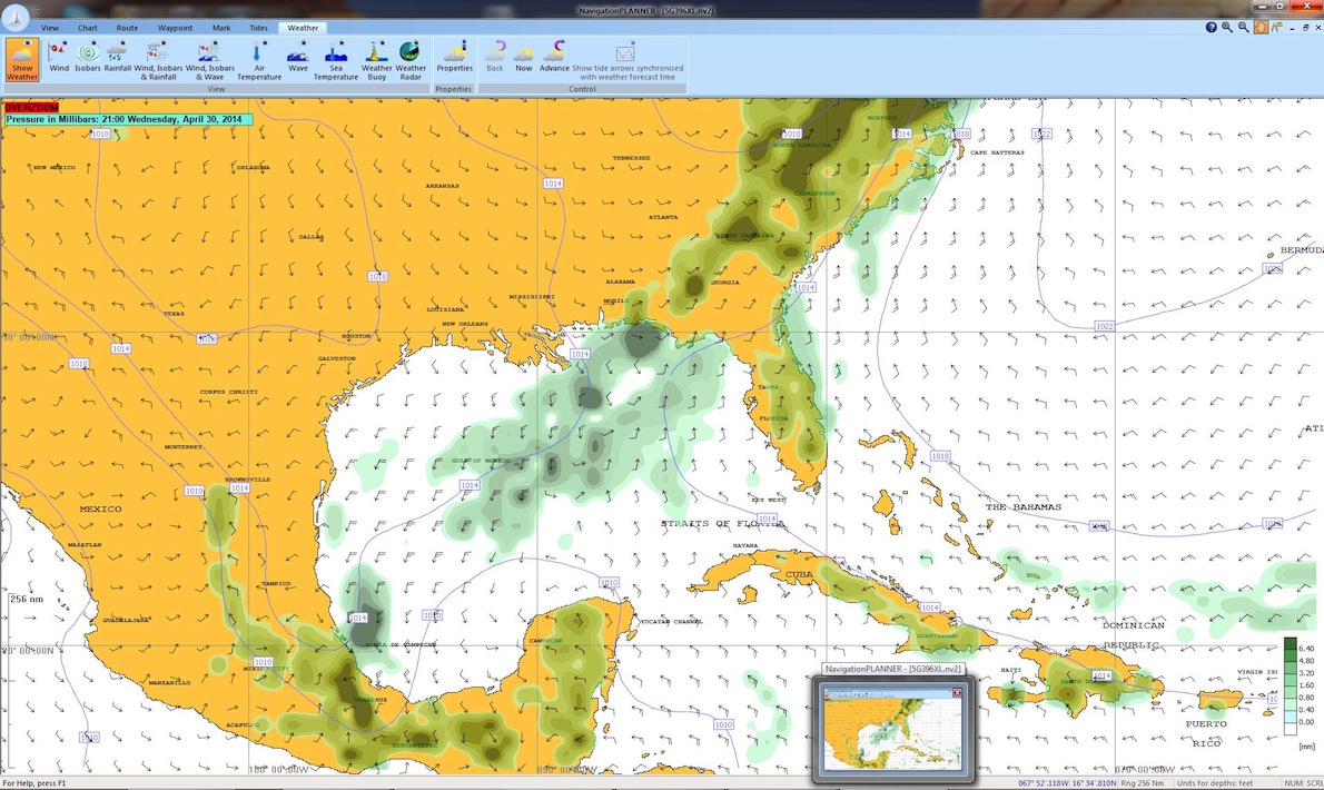
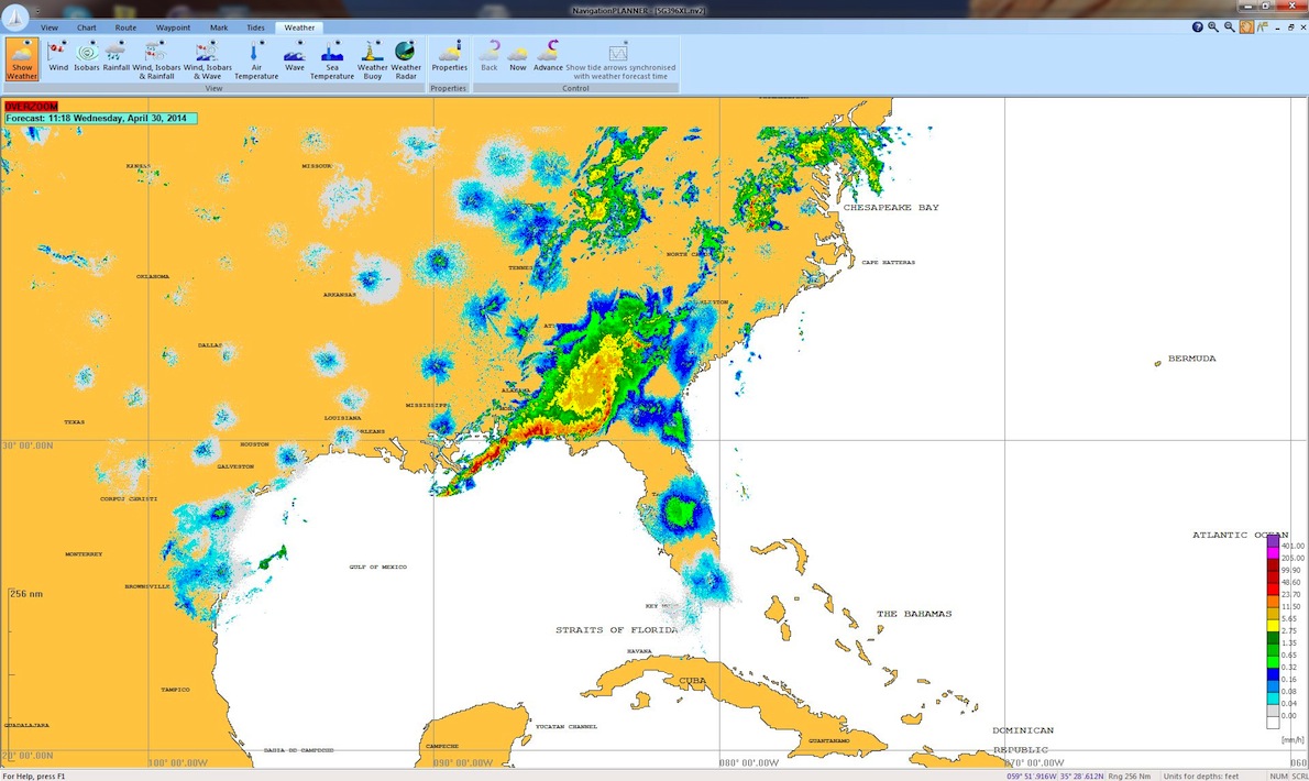
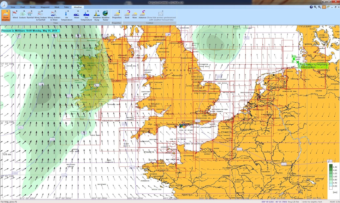
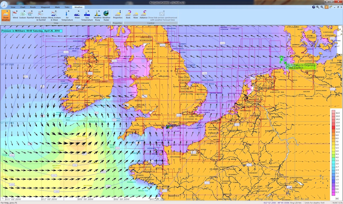
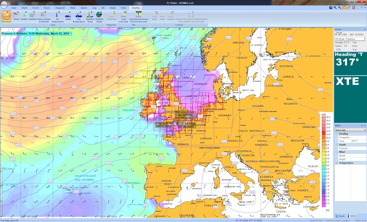
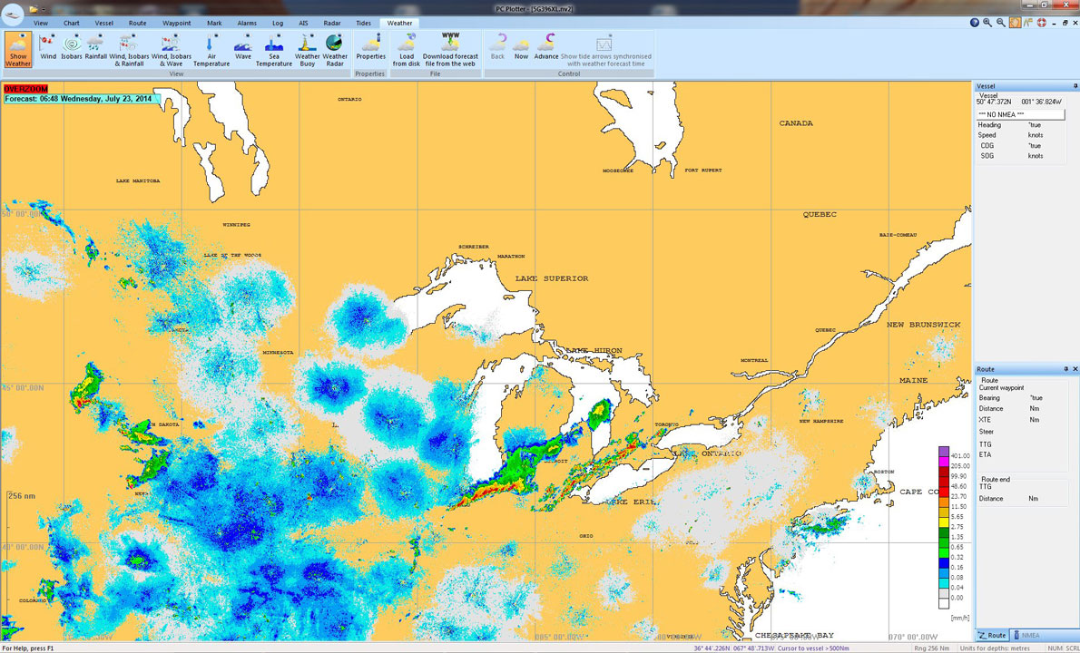
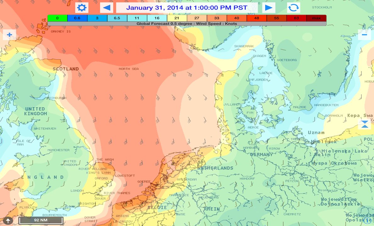
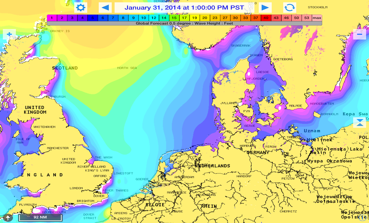
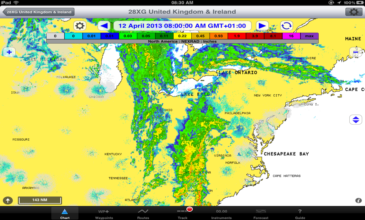
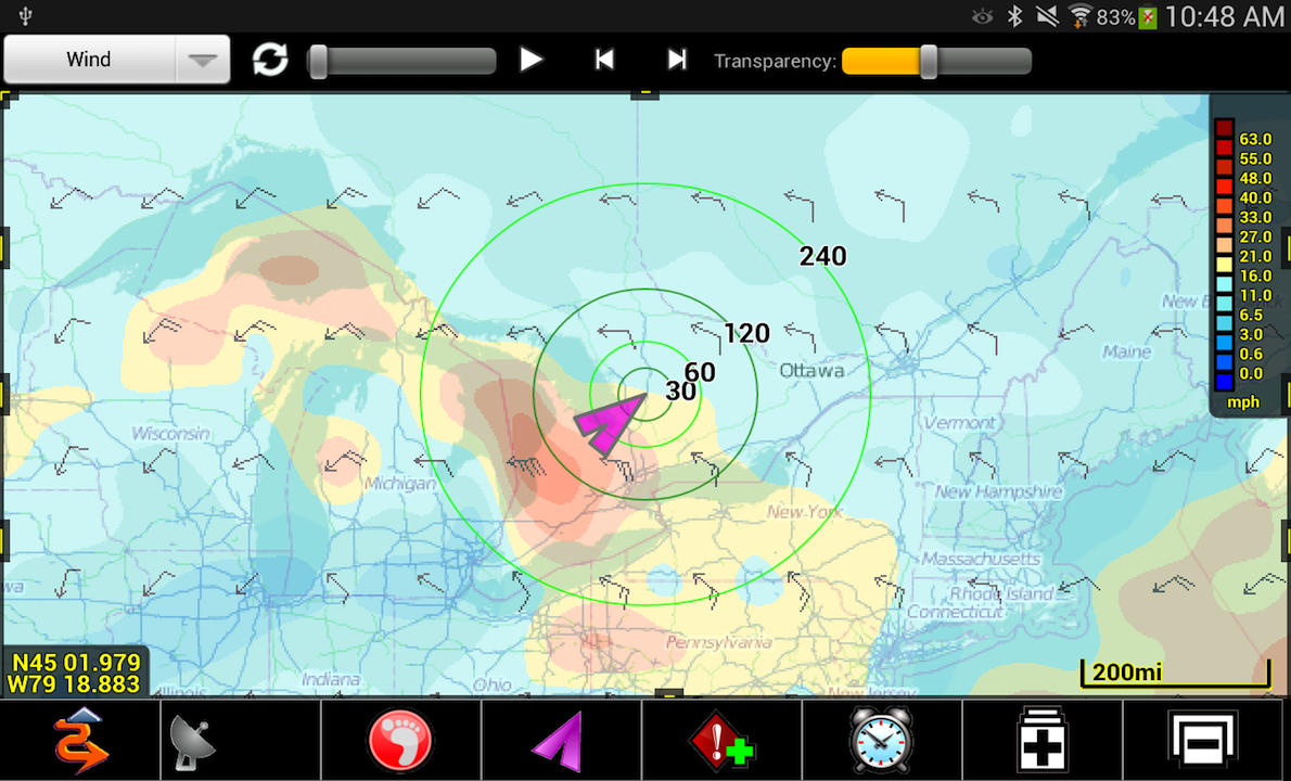
Image: Wind, pressure, rainfall
New NavigationPlanner now with:
http://www.navigationplanner.com/Dealers.html
http://www.chartworks.co.uk/navigation-planner/
Software price: £79.00 (excl vat)
Theyr data services: £5.99 per month to £99.99 per annum
NOW fully integrated with Theyr weather and ocean forecast services.
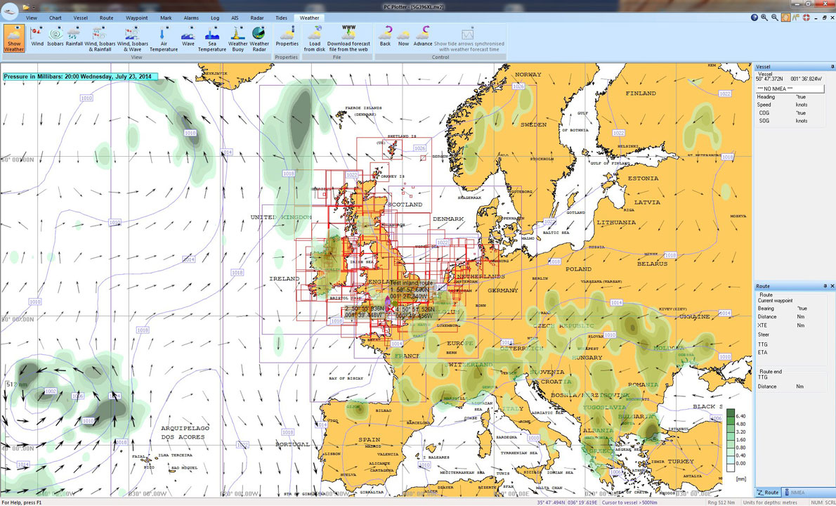
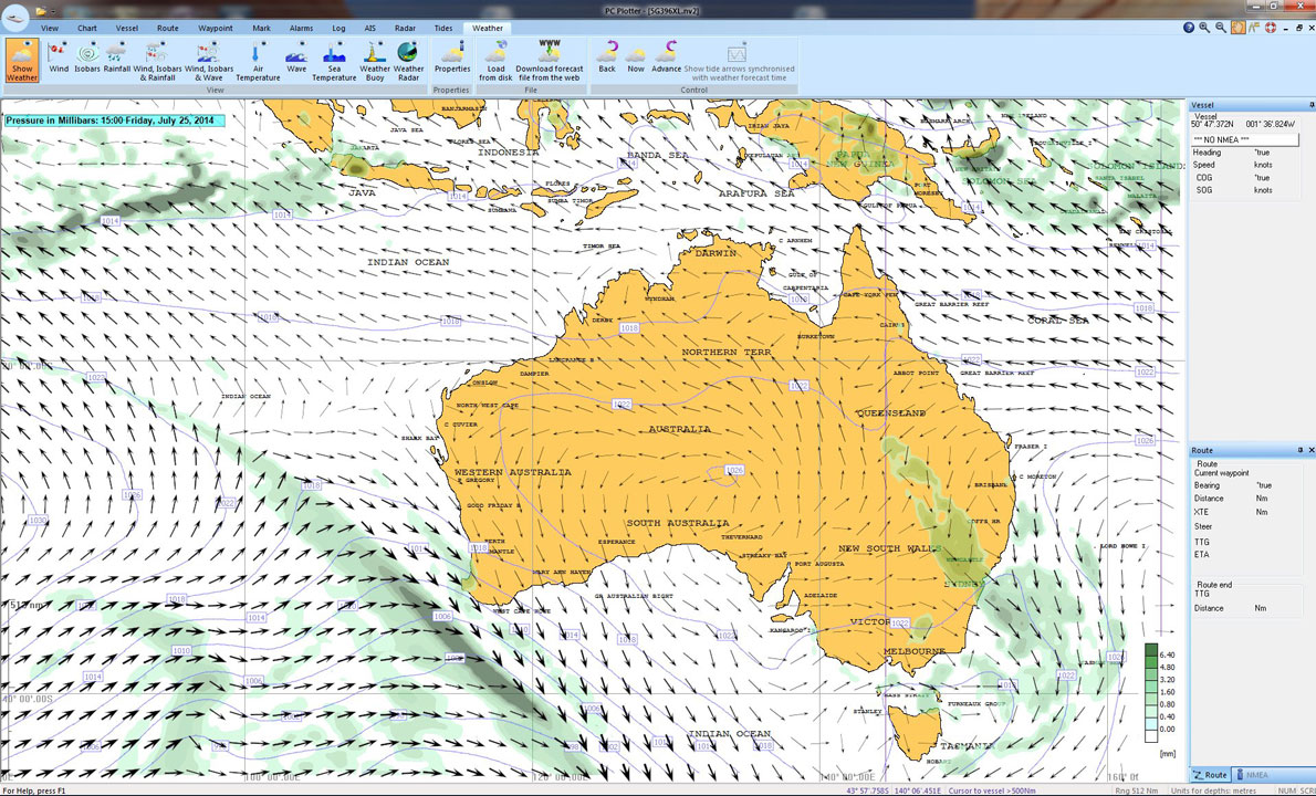
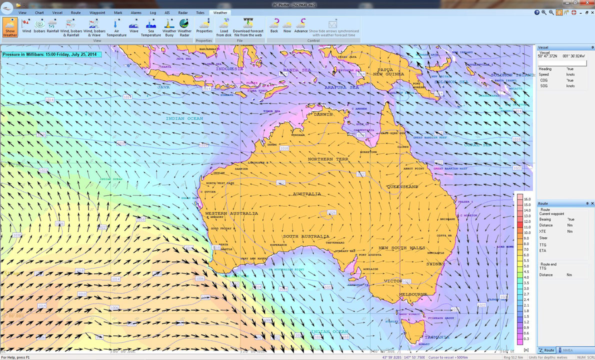
PC Plotter is a simple to use PC or laptop chart plotter designed for sailing, motor yachting and fishing. Ease of installation and ease of use are key features of PC Plotter and if you disagree, we will refund your money!
Use in real time, with a GPS. Without a GPS, planning routes is easy and includes, Dead Reckoning, Distance Off and Bearings from Landmarks, etc.
Access Navionics Vector charts (Navionics Gold, Platinum, Silver, Sonar charts and Hotmaps+) that are stunning in detail, look like paper charts and layers of unwanted information can be turned off.
Route library, support for the new Navionics SONAR charts (great for fishermen and divers), larger vessel icons, improved waypoint display with more waypoint data being able to be displayed, improved route display with intelligent positioning of route point text (and automatic text overlap removal for a less cluttered display) PLUS a lot more. Can still be used without the USB key and allows use on 2 computers (+ 1 spare licence if you have to change computers). WINDOWS 8.1 COMPATIBLE
http://www.pcplotter.com/price.htm
Software price: £250.00 (incl vat)
Theyr data services: £5.99 per month to £99.99 per annum
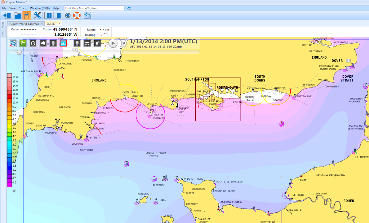
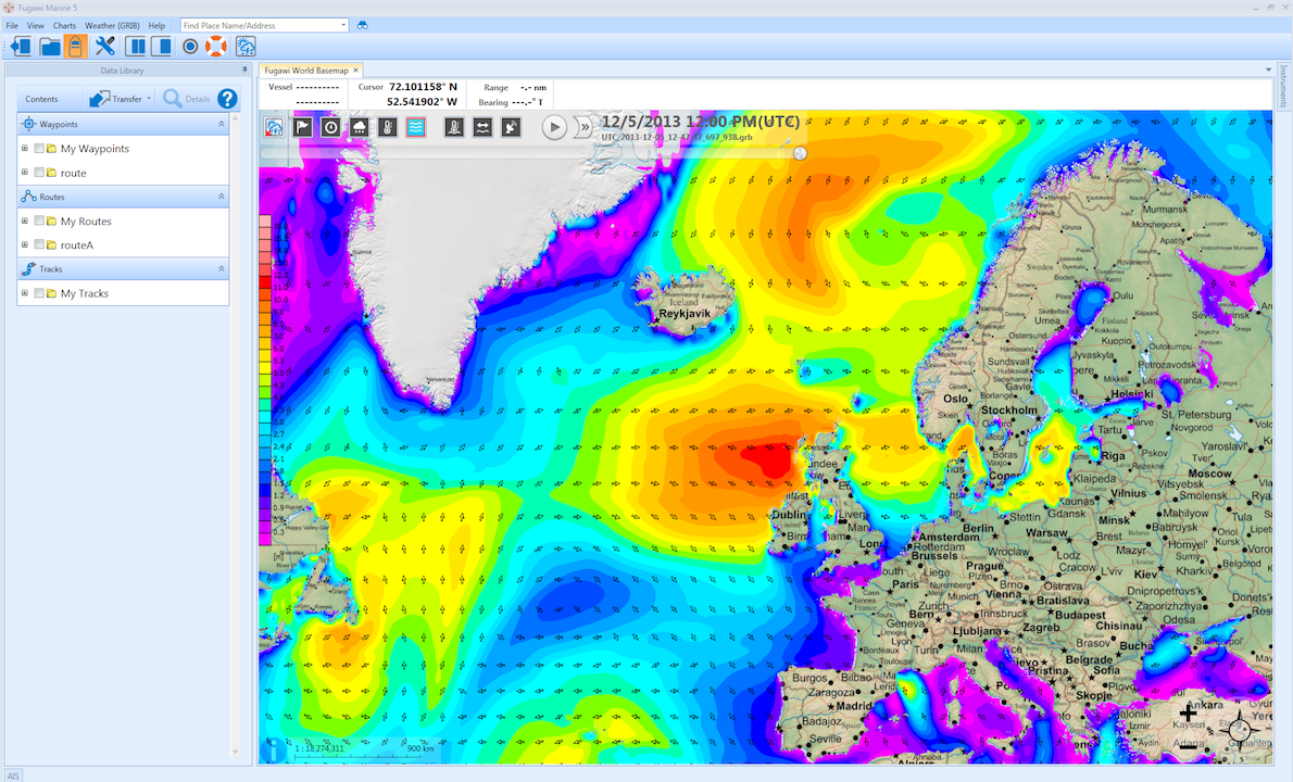
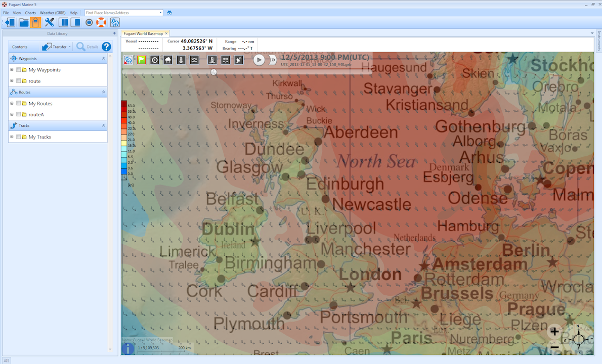
Utilizing state-of-the-art technology, Fugawi Marine 5™ makes your PC navigation experience easy and enjoyable on a desktop, laptop, netbook or tablet. FM5 is also fully integrated with the premium Theyr weather and ocean forecast services.
Fugawi Marine 5 can act as the core of your onboard navigation system, allowing you to open multiple charts in tab view or split-screen with automatic downloads and updates of all NOAA charts. Fugawi Marine 5 supports vector or raster charts, Navionics, CHS, NV and a host of other Charts. FM5 provides uncluttered menu and tool bar with user adjustable buttons, right click and intuitive creation and management of routes and waypoints, and integrates with your NMEA 2000 network, or standalone instruments via NMEA 0183. You can plot your GPS position, plan your routes, program your autopilot, show AIS vessel positions, and view important navigation, engine, wind or weather data on elegant and crystal-clear instrument display.
Software price: US$299.95
Theyr data services: US$9.99 per month to US$149.99
NOW fully integrated with Theyr weather and ocean forecast services.
iNavX™ brings the freely available, official and up to date NOAA RNC raster United States waters marine charts to your iPhone, iPod touch and iPad. Included detailed chart coverage: West Coast, Gulf Coast, East Coast, Great Lakes, Alaska, Hawaii, and US Virgin Islands.
One app for all your devices with access to thousands of charts and maps: official CHS Canada charts, Navionics Gold charts, Fish'N'Chip charts, HotMaps, nv-charts, Hilton's Fishing charts, TRAK Canada lakes fishing maps and Solteknik European waters charts may be purchased separately from X-Traverse.
https://itunes.apple.com/us/app/inavx-marine-navigation/id286616280?mt=8
Software price: US$49.95
Theyr data services: US$ 4.99 per month to $29.99 per annum
PathAway is all-purpose GPS navigation, mapping, and tracking software for mobile devices.
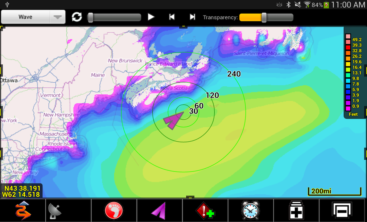
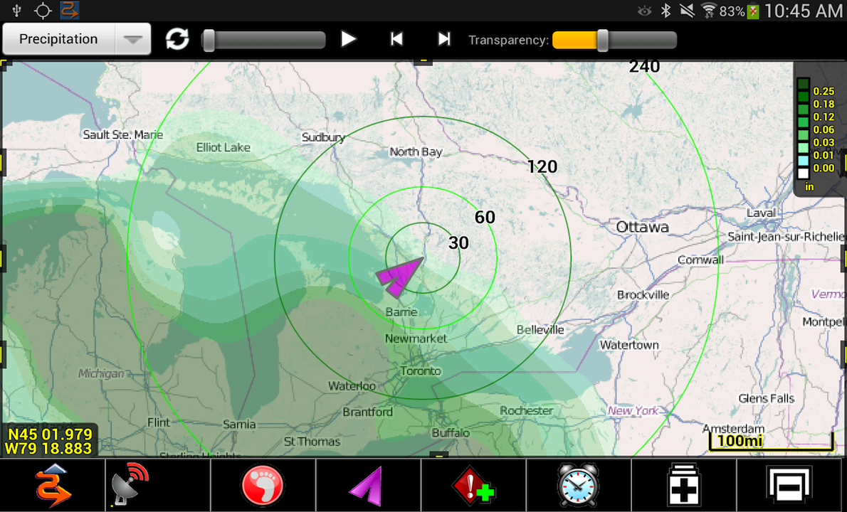
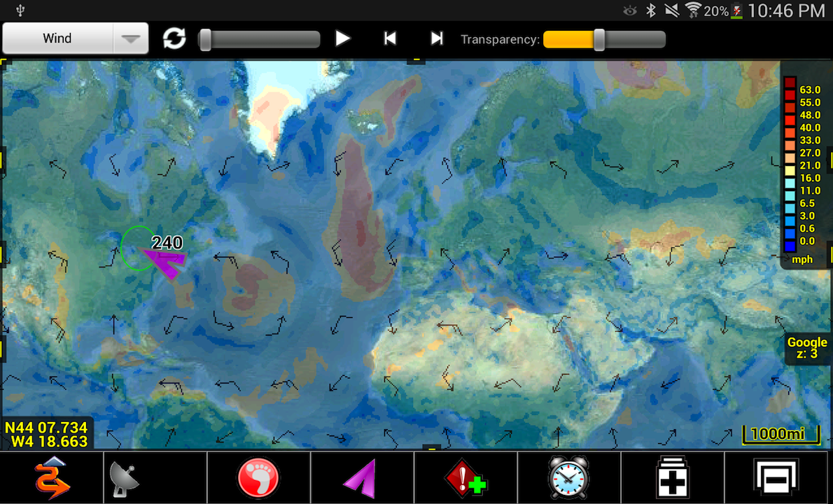
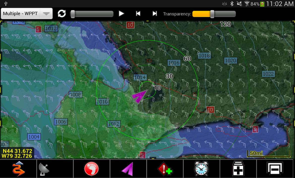
Android Edition now fully integrated with Theyr weather and ocean forecast services.
PathAway is useful for off-road navigation and tracking activities such as aviation, boating, off-road driving, hiking, cycling, touring, geocaching, rally racing, motorcycle touring, athletic training, ballooning, fishing, hunting, paragliding, mountain climbing, ultra-light flying, canoeing, snowmobiling, scuba diving, outdoor education, mapping/GIS, mining, military training, surveying, site inspection, telematics, field data collection, search and rescue, or any application where location is important.
With PathAway you can choose between Lite, Express, Standard or Professional Editions. Available in English, French, German, Italian, Spanish, Czech, Swedish, Portuguese, Chinese Simplified and Traditional.
http://pathaway.com/PWAndroid.htm
http://www.pathaway.com/purchase.htm
Software price: US$ 19.95 to US$ 49.95
Theyr data services: US$ 4.99 per month to $29.99 per annum


